


PRECINCT NORTHWEST, Williams County, Ohio
About
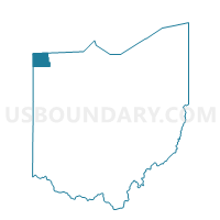
Outline

Summary
| Unique Area Identifier | 653305 |
| Name | PRECINCT NORTHWEST |
| County | Williams County |
| State | Ohio |
| Area (square miles) | 32.99 |
| Land Area (square miles) | 32.64 |
| Water Area (square miles) | 0.36 |
| % of Land Area | 98.92 |
| % of Water Area | 1.08 |
| Latitude of the Internal Point | 41.65779030 |
| Longtitude of the Internal Point | -84.74579050 |
Maps


Graphs
Select a template below for downloading or customizing gragh for PRECINCT NORTHWEST, Williams County, Ohio


Neighbors
Neighoring Voting District (by Name) Neighboring Voting District on the Map
- Voting District 0590202000001, Hillsdale County, MI
- Voting District 0591278000001, Hillsdale County, MI
- PRECINCT BRIDGEWATER WEST, Williams County, OH
- PRECINCT FLORENCE, Williams County, OH
- PRECINCT SUPERIOR NORTH, Williams County, OH
- YORK, Steuben County, IN
Top 10 Neighboring County Subdivision (by Population) Neighboring County Subdivision on the Map
- Camden township, Hillsdale County, MI (2,047)
- Florence township, Williams County, OH (2,026)
- Bridgewater township, Williams County, OH (1,474)
- Superior township, Williams County, OH (1,393)
- Northwest township, Williams County, OH (1,236)
- Amboy township, Hillsdale County, MI (1,173)
- York township, Steuben County, IN (733)
Top 10 Neighboring Unified School District (by Population) Neighboring Unified School District on the Map
- Steuben County Metropolitan School District, IN (18,053)
- Montpelier Exempted Village School District, OH (5,826)
- North Central Local School District, OH (4,159)
- Camden-Frontier School District, MI (3,817)
- Edon Northwest Local School District, OH (3,372)
Top 10 Neighboring State Legislative District Lower Chamber (by Population) Neighboring State Legislative District Lower Chamber on the Map
- State House District 74, OH (118,430)
- State House District 58, MI (91,936)
- State House District 51, IN (62,592)
Top 10 Neighboring State Legislative District Upper Chamber (by Population) Neighboring State Legislative District Upper Chamber on the Map
- State Senate District 1, OH (351,303)
- State Senate District 16, MI (253,123)
- State Senate District 14, IN (139,068)
Top 10 Neighboring 111th Congressional District (by Population) Neighboring 111th Congressional District on the Map
- Congressional District 3, IN (723,633)
- Congressional District 7, MI (676,899)
- Congressional District 5, OH (627,799)
Top 10 Neighboring Census Tract (by Population) Neighboring Census Tract on the Map
- Census Tract 9501, Williams County, OH (4,796)
- Census Tract 9502, Williams County, OH (4,082)
- Census Tract 511, Hillsdale County, MI (3,811)
- Census Tract 9708, Steuben County, IN (3,762)
- Census Tract 512, Hillsdale County, MI (3,467)
- Census Tract 9712, Steuben County, IN (3,378)
Top 10 Neighboring 5-Digit ZIP Code Tabulation Area (by Population) Neighboring 5-Digit ZIP Code Tabulation Area on the Map
- 46703, IN (18,029)
- 43543, OH (7,771)
- 46737, IN (7,068)
- 49232, MI (2,801)
- 43518, OH (2,726)
- 49255, MI (1,939)